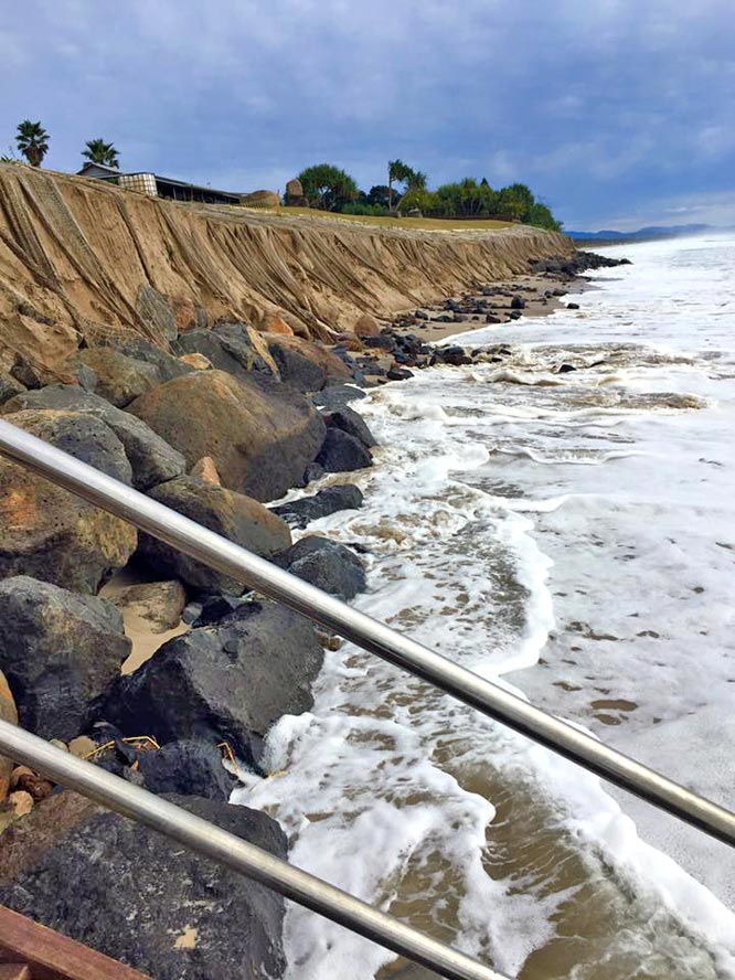
As coastal councils brace for another hammering of their beaches over the weekend, new research methods are emerging that could help local communities assess the threats from beach erosion.
Rosh Ranasinghe, a former NSW coastal engineer, has studied the state’s beaches for more than 15 years – including the frequently hit Collaroy-Narrabeen stretch – to develop new risk maps that can put a dollar value per square metre of exposed properties.
Professor Ranasinghe said his modelling is being applied to places such as Kenya and Sri Lanka. Apart from Sydney’s northern beaches, he recommends Stockton, The Entrance and Byron Bay be priority sites.
“To avoid millions of dollars of damage in the coming years, I would strongly recommend that coastal risk and [optimal setback lines] be determined urgently for at least the 15 identified hotspots in NSW,” Professor Ranasinghe, now with the UNESCO-IHE Institute for Water Education in the Dutch city of Delft, said.
The approach helps to identify more accurately the economically optimal setback line both now and in the future once climate change-related impacts such as rising sea-levels are taken into account.
The setback line marks the region beyond which the risk of damage faced by any property is too great to justify the economic gain the property might potentially provide, he said. By extension, the formula would Indicate which protective measures, such as a new seawall, would be justified if their expected return exceeded their cost.
A spokeswoman for Planning Minister Rob Stokes said the government’s new coastal management bill – including the upcoming State Environmental Planning Policy that would trigger the act – addresses issues raised by the new modelling.
“The coastal reform framework is consistent with the approach proposed,” the spokeswoman said, noting the draft Coastal Management Manual specifically outlines requirements for councils to develop a probabilistic approach to erosion risks.
“Determination of setback lines is a decision for councils to make as part of developing a local environmental plan or development control plan,” she said.
Source article:
“Determination of setback lines is a decision for councils to make as part of developing a local environmental plan or development control plan,” she said.
Councils are incapable of making strong public interest decisions as there are too many vested interests willing to make “political donations”. Until the political donation system is abandoned, politics will be too corrupt to serve the great good of the public.
We already did that!