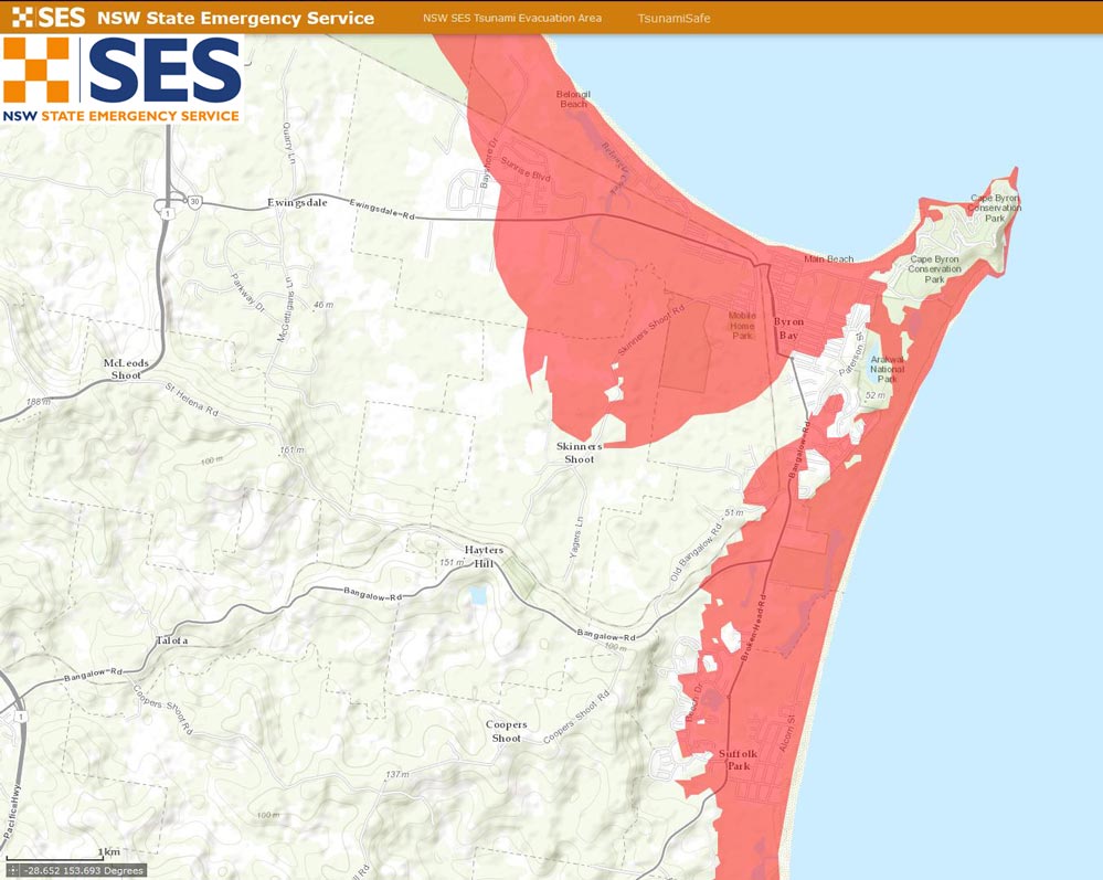
Today the NSW SES has launched new Tsunami Evacuation Maps. These cover the whole NSW coast and show those areas that lie under 10m above sea level, are 1km or less inland and are 10km up an estuary.
IMPORTANT: this message is not a tsunami warning.
In the very unlikely event of a land threat tsunami, the NSW SES will be asking people in the red zone to seek shelter at least 10m up in a sturdy concrete building or to move outside the red zone area to an area of lower risk.
To view the maps go here: http://nswses.maps.arcgis.com/apps/webappviewer/index.html…
It is important to note that these maps are not inundation maps, and represent the areas considered most at risk from modelling of potential tsunami and effects observed elsewhere.
The NSW SES is working on getting more data and refining maps to show potential inundation and evacuation routes in the future.
For safety and preparedness advice go to www.tsunamisafe.com.au